Fretwell, Peter  ORCID: https://orcid.org/0000-0002-1988-5844.
2024
BEDMAP3: Bed topography of Antarctica.
BAS Thematic map series.
Cambridge, UK, British Antarctic Survey.
ORCID: https://orcid.org/0000-0002-1988-5844.
2024
BEDMAP3: Bed topography of Antarctica.
BAS Thematic map series.
Cambridge, UK, British Antarctic Survey.
These maps showcase Bedmap3, the latest suite of gridded products describing the surface elevation, ice-thickness and the seafloor and subglacial bed elevation of Antarctica south of 60° S. Bedmap3 incorporates and adds to all of the post-1950s datasets previously used for Bedmap1 and Bedmap2, including 84 new aerogeophysical surveys by 15 data providers that represent an additional 52 million data points and 1.9 million line kilometres of measurement.
The two sides of this map show the bed elevation in different colour schemes to highlight different features.
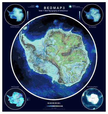
Side 1 displays a cartographic colour scheme, highlighting the elevation of the bed beneath the ice and which parts of subglacial Antarctica rest beneath sea level.
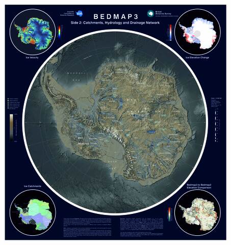
Side 2 shows ice catchments, subglacial lakes beneath the ice and the drainage network of rivers and hydrology that drains meltwater from the interior of the continent to the ocean. The lakes are a mixture of active and permanent lakes identified from surface features and radio echo sounding. The catchments and hydraulic potential flow lines are modelled from Bedmap3 data. Note that not all water accumulations in the modelled data will be true lakes.
![[thumbnail of Open access]](https://nora.nerc.ac.uk/id/eprint/539815/1/Bedmap3%20side%202%20jpeg.jpg "Open access")
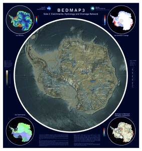
Bedmap3 side 2 jpeg.jpg - Published Version
Available under License Open Government Licence v3.
Download (13MB) | Preview
![[thumbnail of Open Access]](https://nora.nerc.ac.uk/id/eprint/539815/2/Bedmap3%20side%201%20jpeg.jpg "Open Access")
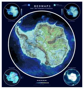
Bedmap3 side 1 jpeg.jpg - Published Version
Available under License Open Government Licence v3.
Download (15MB) | Preview
Bedmap3 side 1 (1).pdf - Published Version
Available under License Open Government Licence v3.
Download (111MB) | Preview
Bedmap3 side 2.pdf - Published Version
Available under License Open Government Licence v3.
Download (172MB) | Preview
Downloads per month over past year


 |